
The TV programme Time Team introduced us to ‘instant’ archaeological results from excavation but it’s the longer running projects and the use of new technology that is producing astounding results.

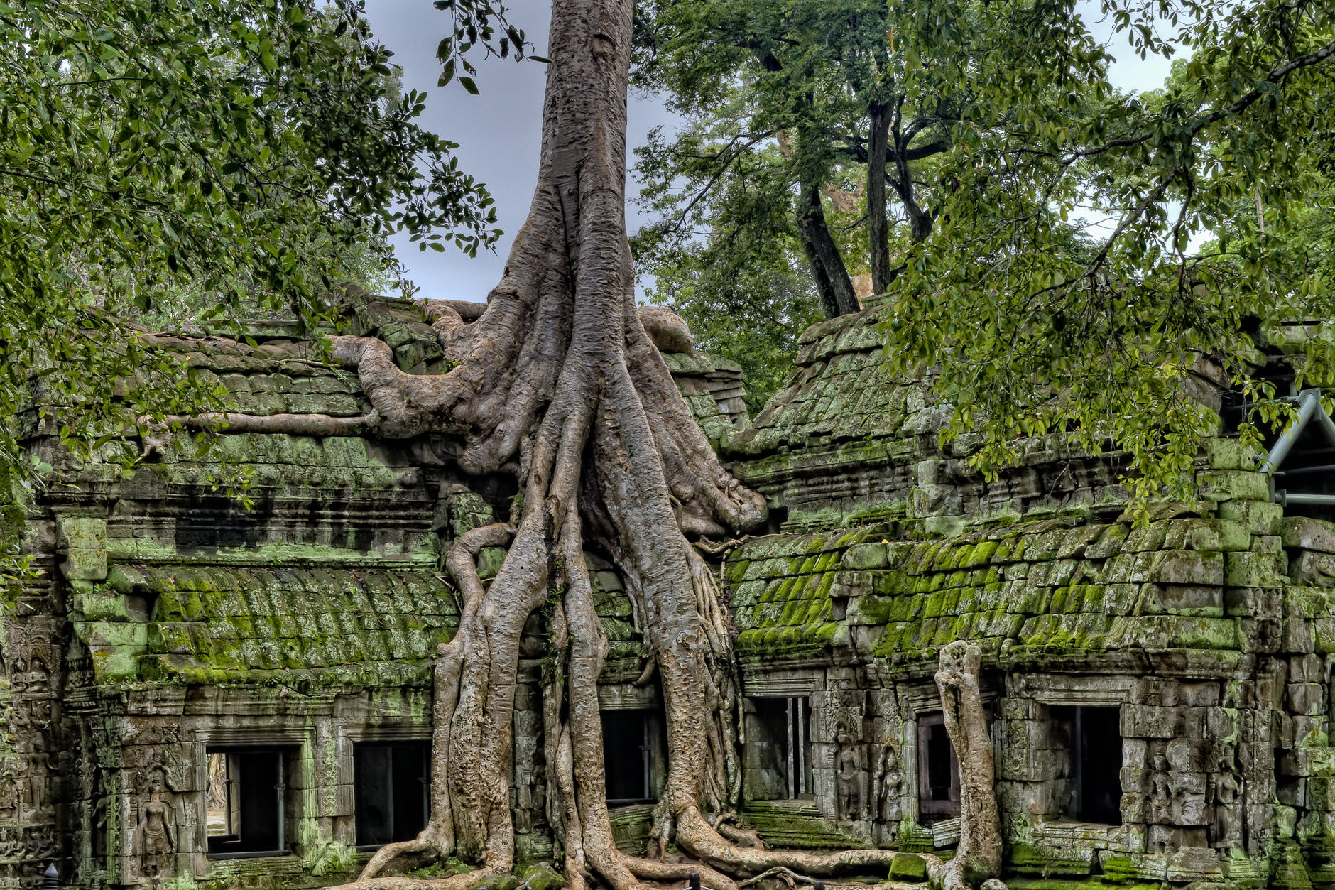
The Greater Angkor region in Cambodia has slowly been revealing its forest hidden past to archaeologists. It is now estimated that it was home to 700,000-900,000 people from the 9th to 15th centuries.
The new estimate, made possible by a study designed at the University of Oregon, is the first for the entire 3,000-square-kilometer mix of urban and rural landscape.
The results involved the collaboration of a 14 long-active Angkor team of researchers . They used multilayered statistical analysis that merged data from historical archives and maps with details obtained of lidar scans of the region in a previous project led by Damian Evans of the French Institute of Asian Studies, in 2012 and 2015.
Sarah Klassen comments “This is the first granular, diachronic, paleodemographic model of the Angkor complex and the most comprehensive of any ancient civilization. This video first appeared in Science Advances: https://advances.sciencemag.org/looku…“
With the combined data, including that from several decades of research by international and Cambodian researchers, the new study revealed population details of Angkor’s ceremonial city center, the metropolis extending outward like modern suburbia and embankments incorporating agricultural areas.
Angkor was a low-density city, with its population spread out across a wide area.
An initial population estimate was for 750,000 residents in an area of 1,000-square kilometers around central Angkor. In this area are stone religious temples, including Angkor Wat that attract tourists.
Beyond the stone temples of central Angkor were homes and locations of supporting structures, all made of organic materials reclaimed by the jungle.

Lidar documented and mapped 20,000 features not seen before, adding to a previous database of 5,000 locations.
UO archaeologist Alison K. Carter explained:
“When you are on the ground in the main parts of the city center it is quite forested.
“As you walk around you can tell there is something in the landscape around you, but you cannot see anything clearly. Lidar gave us a beautiful grid of mounds and depressions, which we think were little ponds.”
The new data have been organized into different periods of Angkor’s growth, particularly in the lifetimes of kings who were most influential to infrastructure changes, said Carter, who heads the UO’s Southeast Asian Archeology Lab.
Lidar showed where houses, which had been built on mounds and elevated on posts, had stood. Researchers estimated that five people lived in each household and extrapolated that data to assess the region’s total population.
Miriam T. Stark, director of the Center for Southeast Asian Studies at the University of Hawaii at Manoa said:
“Studying Angkor’s population is important for envisioning the future’s urbanism with respect to global climate change.
“Angkor was a tropical city that persisted through centuries of political and climatic volatility. Tracking its history and tipping point could help urban planners understand some kinds of constraints that face increasing numbers of the world’s cities.”
The research showed that there were periods of growth in Angkor between 770 and 1300.
Future research, Fletcher said, will more deeply examine the expansion of population clusters.
“What was the population of Angkor prior to this sample period? We have to get below all of the current structures with archaeology to predict and model earlier periods,” he said.
Roland Fletcher of the University of Sydney and director of the Angkor Research Program, a collaboration with Cambodia’s Authority for the Protection of the Site and Management of the Region of Angkor,explained:
“We predominantly are living in giant low-density cities around the world that are similar to Angkor, which displayed serious vulnerability to severe climate change.
“We really need to know the mechanics of how Angkor worked and what people were doing to get some idea of how referable those experiences are to the risks that we face in our future.”
The findings published May 7 in the journal Science Advances.

Leave a Reply