
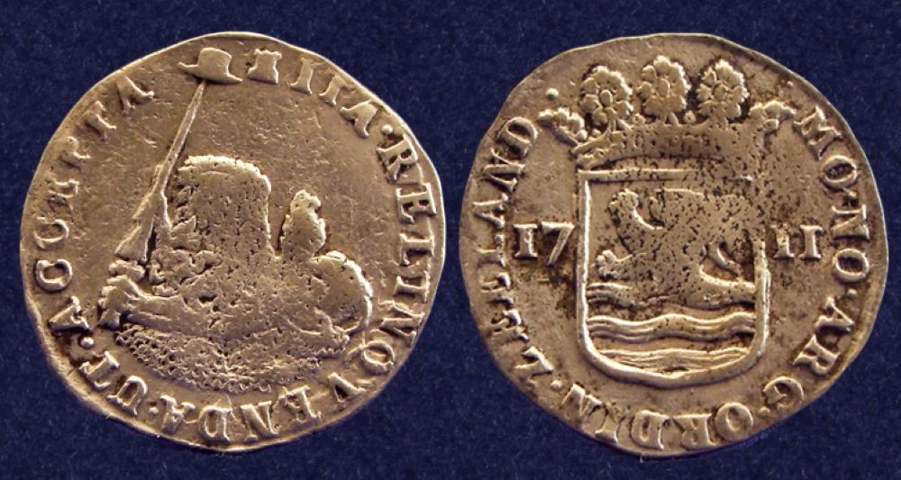
The Dutch East India (VOC) ship Zuytdorp was lost without trace in the winter of 1712 en route from the Netherlands to Batavia (now Jakarta). The vessel was carrying a rich cargo and considerable silver bullion. Western Australia Museum
In the time of the sailing ships, weather and uncharted waters led many to founder on rocks or succumb to huge waves. Off the coast of Western Australia four Dutch shipwrecks have been found within the last century, with the Batavia wrecked in 1629, and the horrors of its mutinous crew arguably the most infamous.
In research recently published in the Journal of Maritime Archaeology, Flinders University archaeologists Dr Ruud Stelten and Professor Wendy van Duivenvoorde analysed the ship logs of The Dutch East India Company ship, the Zuytdorp, wrecked in 1712. They also sutdied contemporary cartographic and navigational knowledge and weather patterns at the time in a bid to understand how the ship went down.

Discovered in 1927 about 60km north of the WA coastal town of Kalbarri, and formally identified in 1958, the Zuytdorp was travelling from the Dutch port of Vlissingen on the way to Batavia, now present-day Jakarta, when it became lost at sea in 1712.
Dr Stelten from Flinders’ College of Humanities, Arts and Social Sciences explained:
“Since the wreck of the Zuytdorp was identified, many theories exist as to how the ship crashed, including poor navigation or misadventure, but despite being the subject of a number of archaeological investigations, the exact circumstances of the ship’s demise have remained unclear.”
As is the case with other shipwrecks off the coast of WA, one of the leading theories as to why the ship crashed was longitude determination; that is to say without the crew knowing exactly how far east they were and therefore how far away they were from the western coast of Australia, its coastline could suddenly appear without warning.
By analysing contemporary cartographic and navigational knowledge, the authors assessed the charts available to the ship’s officers, coastal visibility, and signs indicating proximity to land as recorded in contemporary ship logs.
Professor van Duivenvoorde, a leading maritime archaeologist in Flinders’ College of Humanities, Arts and Social Sciences, said:
“Our analysis suggests the Zuytdorp’s officers had access to sufficient cartographic information to navigate the Indian Ocean and the Western Australian coastline effectively.
“The crew noted numerous warning signs that the vessel was nearing the coast and took various measures to avoid a collision, so the theory that they had a sudden and unexpected encounter with the shore is an unlikely scenario.
“The more likely scenario is that the ship reached the Australian coastline intentionally and was driven ashore by a storm.”.
The research could help to locate the ship’s lost anchors and could prove a useful method for uncovering what happened to other shipwrecks around the world.
Of the seven VOC, English East India Company, Portuguese and American East India ships known to be lost off the coast of Western Australia, Zuytdorp is the only wreck from which survivors did not reach Batavia to tell the tale. Western Australia Museum
“By examining historical records, navigational charts, and weather conditions, we have been able to piece together a more accurate picture of what likely happened to the Zuytdorp all those years ago,” said Dr Stelten.
“This study highlights the resilience and navigational skills of the VOC officers. The Zuytdorp’s wrecking was not due to a lack of skill or information but rather the unpredictable nature of the sea.”
The paper ‘Mishaps in the Land van Eendracht: Exploring the Cause of Zuytdorp’s Wrecking’ by Ruud Stelten and Wendy van Duivenvoorde is published in the Journal of Maritime Archaeology. The research was been funded by the Australian Research Council (Grant Nos. LP210300960, LP210300960).


Leave a Reply