

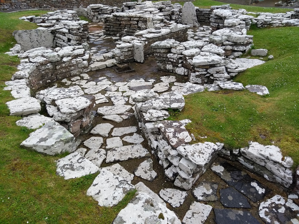
Visiting the Neolithic village of Skara Brae is top of the list for tourists coming to Orkney. 2020 and Covid restrictions meant that was not possible for most of the year.
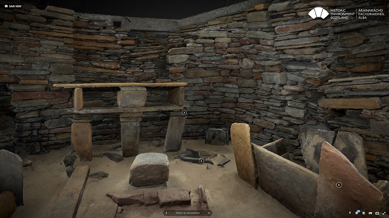
Now a new digital model of Skara Brae has been developed.
The model, available to view on Sketchfab, allows virtual visitors an immersive digital experience of the Neolithic settlement, including the opportunity to gain virtual access to House 7, the best-preserved house at Skara Brae which is not normally accessible to the public.

The 3D model has been created through a process of laser scanning, using ultra-fast, high-resolution laser scanners which capture 3D spatial data in the form of a point cloud. To capture a photorealistic model, hundreds of overlapping images of the site are then combined with the 3D data, in a technique known as photogrammetry.

Coastal erosion and great storms made the village of Skara Brae uninhabitable for those early islanders but as the process continues, accelerated by climate change, the village itself is now threatened. The 3D model allows the viewer to understand the impact of coastal erosion is having on the World Heritage Site.
The model was developed by Historic Environment Scotland who manage the site.
Al Rawlinson, Head of Digital Innovation and Learning at HES, said:
“We’re really pleased to make this 3D model of Skara Brae available, which not only offers an innovative way to access this unique site, but one which also showcases how we are using cutting-edge technology to monitor and maintain our historic environment.
“As we reflect on COP26 and the challenges ahead, we want to demonstrate that in order to protect our past from the impacts of climate change, we must look to the future. Digital technology such as this will be a vital tool to help us better understand and manage the climate risks to our historic places, and to share their climate stories.”

Dr Alistair Rennie, Dynamic Coast Project Manager, said:
“Whilst the challenge posed by climate change is stark, new technologies like those deployed by HES, increase our ability to monitor, learn, collaborate and find new approaches to become sea-level wise and adapt to our future climate.”
The model was created using laser scan data captured as part of the Rae project, which aims to accurately digitally document over 300 heritage sites and their collections in the care of HES.
View the 3D model of Skara Brae on Sketchfab.

Leave a Reply