
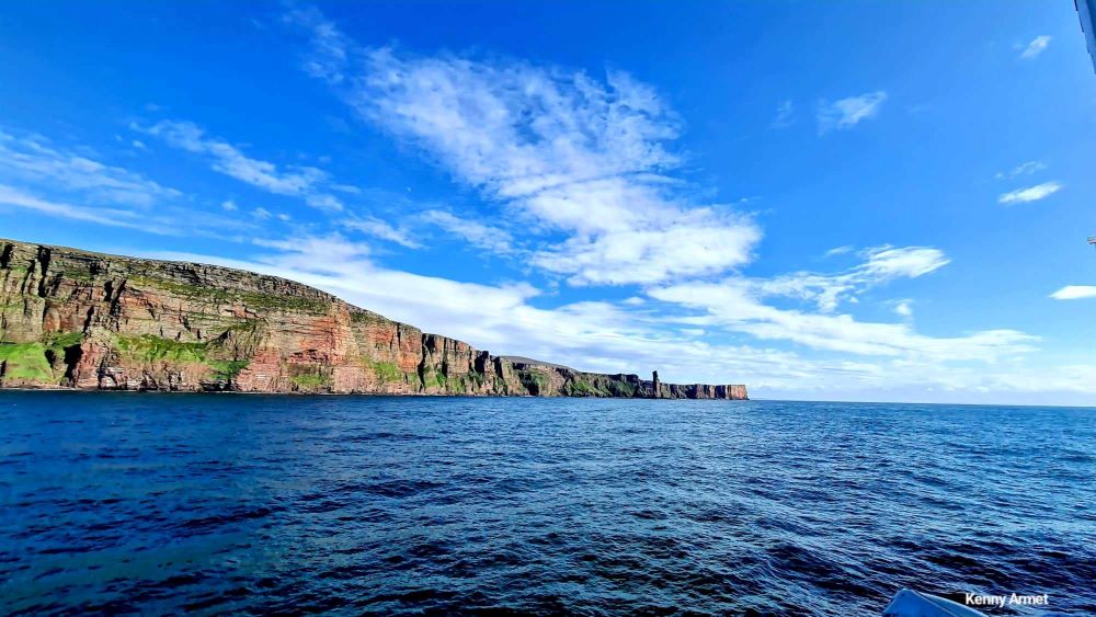
The Neolithic village of Skara Brae was exposed by a huge storm in the 19th century which revealed some of the structures buried for thousands of years. The village was once further inland but the sea broke through and the Bay of Skaill was created. It continues to evolve, threatening the very existence of Skara Brae which has been protected by a sea wall since the 1920s. Other archaeological sites in Orkney are also facing increasing exposure as they perch ever closer to the pounding of the waves.

Then add into the mix climate change with rising sea levels and increasing numbers of storm events. Around the world islands and coastal communities are experiencing the results of the damage we have done to our planet. This is a climate emergency.
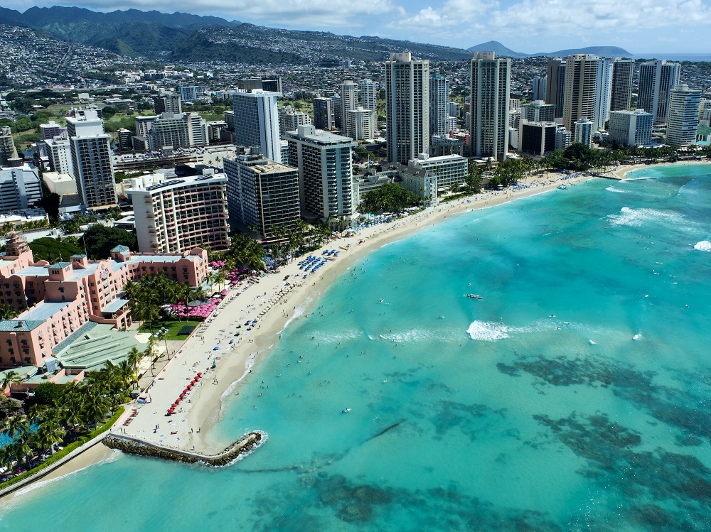
How beaches form and change is a fascinating complex study. Researchers at The University of Hawaii have been studying the famous Waikiki Beach, Honolulu. The researchers found that the sand at Waikiki Beach moves from one end to the other – termed ‘longshore transport’.
Waikiki-based visitor activity generated an estimated $432 million in tax revenues for the state and counties. In particular, Waikiki generates a substantial amount of property taxes for the City and County of Honolulu. (2003)
https://files.hawaii.gov/dbedt/economic/data_reports/e-reports/econ_waikiki.pdf

Drones were used to survey the beach over a two year period. The images taken were then used to create 3 dimensional models. The drones were quite cheap ones readily available in retail outlets. The researchers found these to be very effective at producing the images and building up the survey data. Having more accurate data on how the beach is changing with the action of storm surges and rising sea levels means that planners can hopefully do more to protect the coast.

The work is now being extended to other beaches. Drone survey techniques are being used to document every beach on Oʻahu which will provide a high resolution baseline of the status of beaches today. The researchers are able to compare satellite imagery back to 1990.
Chip Fletcher, CRC director and interim Dean of the UH Mānoa School of Ocean and Earth Science and Technology, explained:
“To effectively manage our coastline for ecological, societal and economic sustainability, we need this improved understanding of the behavior of our beaches and nearshore dynamics.”
Click on this link to access the report: Weekly Small Uncrewed Aerial System Surveys, Structure from Motion, and Empirical Orthogonal Function Analyses Reveal Unique Modes of Sediment Exchange Generated by Seasonal and Episodic Phenomena: Waikīkī, Hawaiʻi, published in Remote Sensing.
Historic Environment Scotland (HES) the organisation which manages many of Orkney’s archaeological sites, including Skara Brae, also uses drones to survey the coasts. HES has an Aerial Survey and Remote Sensing Team using this technology to assess the impact of climate and coastal changes we are experiencing in Orkney. Like the researchers in Hawaii, the images taken can be put together to produce a 3D version. In addition to this work the drone surveys are able to document sites across Scotland from above giving a ‘bird’s eye view’ of our historical places that many never have been done before.
Drones have become a valuable tool in the way we can survey our coasts and combined with satellite data we have the evidence to make informed choices about how we can protect them.
As world leaders again meet to discuss the Climate Emergency at COP27 we need urgent action from politicians to limit the impact of climate change. Managing our coastlines is vital but with rising sea levels and the increasing severity of storm events world leaders have to wake up to what we have done to our planet.

Fiona Grahame


Leave a Reply