
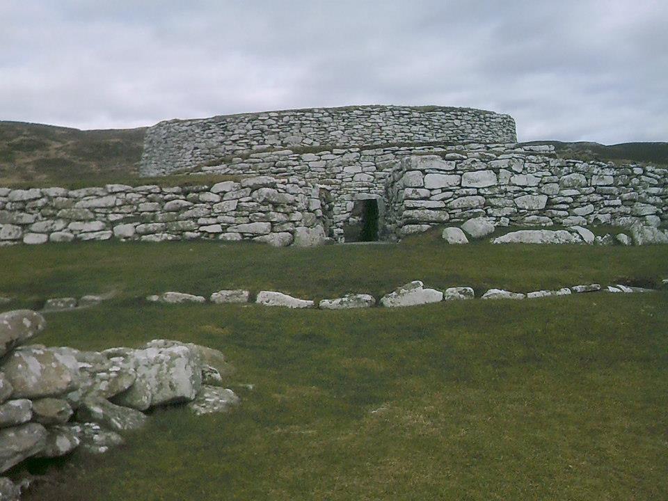
An American Professor toured Orkney and Shetland in 1890. His account of his trip was published in the local paper of the time ‘The Orkney Herald’. In this episode he writes of his experiences visiting the Broch of Clickimin.
‘The second broch, that of Clickimin, interested me fully as much as the first, though it is in a far more ruinous condition. The inner structure and the general principle of the double wall are identical with those of Mousa; but we have, in addition, the remains of a broad wall of circumvallation, and, besides, guarding the spit of land or causeway, connecting the holm with the shore, a second outer wall of guard, built apparently in the form of a segment of a circle, with the two ends joining the interior wall’

‘Furthermore, a long, low, covered passageway led from the land spit to the interior of the broch, furnishing the sole entrance, and just at its beginning there are at one side the foundations of a small rectangular structure, which may have served as an additional bastion, or guard house, to protect the entrance.
I observe that Sir H Dryden looked upon the wall, which I have styled ‘exterior’, as a portion of the wall of circumvallation, and the extra segment of a wall as an interior wall of guard (Tudor). ‘

‘In the broad space between the wall of circumvallation and the broch itself are the foundation lines of a multitude of structures. Something similar to this I noted twice elsewhere, near the ruins of a broch at Scapa in the Orkneys, and at the ferry between Bressay and Noss (Shetland), likewise the site of a broch.
These are apparently the remains of apartments subsidiary or posterior to those found in the central structure. Towers of this character, varying in details, but conforming in the main to one plan, occur, as I have mentioned, in great numbers in these islands.’
Historic Environment Scotland states:
“The monument consists of the broch of Clickimin. The broch of Clickimin, or Clickhimin, is a complex archaeological monument, with evidence dating from the Bronze Age (around 1000 BC) through to the late Iron Age (around AD 500)
The main elements, in ascending date order, are a small house and outbuilding of late Bronze Age date, an early Iron Age ring-fort, a middle Iron Age blockhouse and broch (with later alterations), a later Iron Age wheelhouse-type dwelling and several lesser foundations representing late Iron Age dwellings. A causeway leads towards the site, which is situated on a small rock knoll beside a shallow loch.
The area to be scheduled is irregular on plan, bounded to the S by the fence marking the limit of the area in state care and on the remainder of the perimeter by a line running approximately 20m out from the edge of the peninsula on which the monument stands, so that a portion of the bed of the loch is included.
Within this area evidence relating to the construction and use of the various elements of the monument is likely to survive. The area to be scheduled is marked in red on the accompanying map.
Statement of National Importance
The monument is of national importance as one of the most comprehensively excavated examples of a late prehistoric defensive settlement. Despite the extensive excavation and reconstruction, much remains unanswered, especially as regards the evolution of the physical setting and the fine details of construction sequence.”


For other articles in this series used the search button on our website.
Fiona Grahame


Leave a Reply