
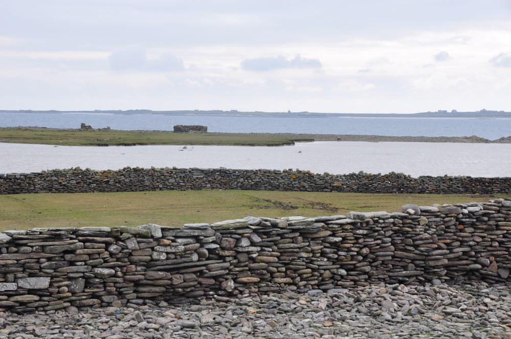
The first in a series of four walks around North Ronaldsay, following the route of the island’s sheep dyke, takes place this Thursday, June 6.

The walks are part of Thirteen Stone Miles, a project funded by the North Isles Landscape Partnership Scheme (NILPS) in partnership with the North Ronaldsay Trust. It aims to gather community stories, surveys and studies which will add to the store of island knowledge about the sheep dyke, its environment and its role in the island’s past and present. This will include ethnological and historical information about the traditional, communal management of the sheep, ecological and habitat information from the foreshore and archaeological surveys of the dyke and archaeology connected with the dyke.
The research will inform interpretation and help promote the island and the sheep to visitors and perhaps new islanders. It will also provide a record of some of the heritage relating to the sheep and the dyke to pass on to future generations. The project will be underpinned by important themes such as sustainable living, the conservation of cultural and built heritage and rising sea levels. A launch event was held in August last year, working with islanders to record sheep dyke features and names on a large map. This started the process of recording the names for the sheep punds (enclosures along the shore for gathering sheep) and slaps (gates in the dyke)
The shore walks with ORCA archaeologist Dan Lee will visit known archaeological and heritage sites along the sheep dyke, record features in the dyke itself using photographs and recording any new sites that are encountered.
The project team are Dan Lee and Antonia Thomas (UHI Archaeology Institute), photographer Rebecca Marr and film maker Mark Jenkins (KOLEKTO), ecologist and artist Becs Boyd.
The schedule for the walks is:
Thursday, June 6, 2024
Walk 1: Muckeen Slap to Westhill Slap.
Lunch stop: Loch Gretchen.
Distance: c. 4km.
Thursday, June 13, 2024
Walk 2: Westhill Slap to Ires Taking Pund.
Lunch stop: Lenswick.
Distance: c. 5.5km.
Wednesday, June 19, 2024
Walk 3: Ires Taing Pund to slap at Scotsha.
Lunch stop: MacRae Pund).
Distance: c. 5.5km.
Monday, July 1, 2024
Walk 4: Slap at Scotsha to Muckeen Slap.
Lunch stop: Viggay Banks Slap.
Distance: c. 5.5km.
All walks will start at 10am (meet at slap/pund) and finish at 4pm. Lunch stops will be half-way, around 1pm. They are free – no need to book – so join us for all or part of the day!

All walks will start at 10am (meet at slap/pund) and finish at 4pm. Lunch stops will be half-way, around 1pm. They are free – no need to book – so join us for all or part of the day!


Leave a Reply