
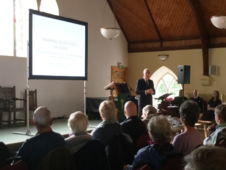
Professor Withers, Geographer Royal of Scotland and Ogilvie Chair of Geography at the University of Edinburgh was one of the guest speakers at the Orkney International Science Festival.

On Friday 6th of September to a packed King St Halls, Kirkwall he gave an illustrated talk on Mapping Scotland’s Islands.

The map of Scotland is relatively new coming around the mid 16th Century as the Kingdom of Scotland was developing. The first map depicting Scotland from this time shows very little of the islands but significantly it places the land mass of Scotland at its centre. Later on, Mercators map of 1595 shows the islands as more recognisable. The map is still not complete – not what we would think of today as accurate.

Another map, Portuguese, of 1560 depicts Scotland and England as separate nations but attached at the border by a ‘clasp’.
These early maps were not the work of Scots but during this period Scotland is emerging into the modern state which we are familiar with today. Creating maps of Scotland by Scots was part of a growing political identity – of nationhood and it is not until the late 16th century that Scots are mapping for themselves.
Timothy Pont (1565- 1614) was Scotland’s first map maker and travelled round the country recording the details of the land he traversed. 78 of his unique maps are kept in the National Library of Scotland. These amazing manuscripts are only with us today because the Dutch cartographer Blaeu used Pont’s work to produce his own engraved colourised maps and the 78 originals we have in Scotland are the ones sent back by Blaeu for further clarification.

Pont’s work was not published in his lifetime but 50 years later by Blaeu. With Pont the map starts to show symbols and explanatory text. Nicholas Crane (the Map Man) made a couple of programmes where he followed in the footsteps of Timothy Pont and there are books about him such as, The Nation Survey’d: Timothy Pont’s maps of Scotland
It is Blaeu’s map and later where ‘Pomona/Pomonia’ is used for Mainland, Orkney. A name never used by Orcadians it continues in use till the end of the 18th C in maps.
The strategic importance of islands both for military purposes and the flow of trade is shown in the interest governments showed in commissioning map making. Shipping was how goods and people moved about and it grows increasingly important to chart the waters around Scotland.
John Adair is commissioned by the Scottish Government in the late 17th and early 18th centuries to map Scotland. In 1698 he produces a map of Orkney . Islands are marked and hazards to shipping recorded. Adair never completed his maps of Scotland’s islands and coasts. His meticulousness results in him being slow and he is hampered by lack of funding from the Scottish Government of the day. John Adair’s maps are also in the National Library of Scotland.
Orcadian Murdoch MacKenzie uses triangulation to produce maps which could show much more detail about features especially navigational ones. You can read more about Murdoch MacKenzie here: Murdoch Mackenzie: Orkney’s Great Mapmaker
The Admiralty commissioned MacKenzie to map the West coast of Scotland and Ireland in 1751. He uses symbols with an explanation of what they stand for. MacKenzie is using new surveying methods and mathematics bringing them into the language of modern map making.
By the early 19th Century the Stevenson Lighthouses are being constructed which not only use maps themselves but also become features on maps. Interestingly as technology takes over and we rely on providers like Google maps it is easy to be fooled that somehow these are more accurate than those made by early surveyors. Professor Withers takes as an example of this the episode in 2013 when Google wiped Jura off their maps. A mistake soon rectified but only after they were alerted to it.
The military have always seen the importance of maps.

A map of the Treshness Isles depicts the Hanoverian stronghold that was established there during the first half of the 18th Century. Hanoverian troops were stationed on Treshness after the first Jacobite conflict.
Detailed plans show Fort Charlotte in Lerwick, Shetland, by Andrew Fraser in 1783 and into the 20th Century maps of South Uist for the rocket range which was established there.
Mapping these areas of strategic importance is also of interest to other countries as Professor Withers illustrates with a Russian made map – extremely detailed – which must have been informed by surveying on the ground level. Russia once had the world’s largest map making sector employing 36,000 people.
Maps don’t just record what is there but also what might be there. They can give us a picture of a future Scotland, including how historically people viewed ‘improvements’.
The Agrarian Revolution which swept through Scotland changing centuries old farming practices produced very detailed maps of farming. At 17, William Bald, apprenticed to John Ainslie, drew up very detailed maps of the Western Isles in the early 19th C. His accurate maps show the measurements of the fields, the crops grown and the details of land use.
There are also future maps of projects which failed to materialise like John Wood’s planned development of Stornoway.
And there are maps which depict a snapshot in time – as in the charts of Balta Sound where its once booming herring industry fell apart with the outbreak of World War 1. By 1939 very little remained of this massive driver of the economy with buildings and even piers no longer there.
Future mapping also produced what would happen if the proposed Super Quarry got planning approval in Harris. Fortunately that proposal and what it would do permanently to the landscape, was eventually rejected.
Professor Wither’s talk was fascinating. His contention was that islands emerge through mapping. Islands are produced by the representation we construct of them. Maps produce the islands.
Recently, nearer to home, in the Northern Isles, we became accustomed to seeing maps with Shetland and sometimes Orkney stuck in boxes. It is the former LibDem MSP Tavish Scott who deserves the credit for insuring that the Islands Act means that Shetland must be accurately depicted in maps and no longer set into a box.
Islands Minister in the Scottish Government Paul Wheelhouse said:
“It ensures Shetland will no longer be ‘boxed off’ on maps which has been a cause of irritation to those living in Shetland.
“When producing a map of Scotland, the Shetland Islands must therefore be displayed in a way that accurately and proportionately represents their geographical location in relation to the rest of Scotland.”
Anyone who thinks maps and the depiction of islands (and nations) on them are of no importance hasn’t been paying attention.
Images are of slides presented by Professor Withers and are ‘Reproduced with the permission of the National Library of Scotland’ .
Professor Withers talk was supported by the Royal Geographical Society
Reporter: Fiona Grahame


Leave a Reply