
Today 8th April:
Any early snow over Shetland turning to rain soon after dawn Brighter with showers in the afternoon, turning wintry in evening. Southerly gales at first over Shetland then fresh to strong southwesterlies, increasing gale over Orkney later. Less cold. Maximum temperature 8 °C.
Tonight:
Showery, these showers turning wintry at times later this evening then to snow or hail overnight. A short, sudden spell of severe gales, easing again overnight. Minimum temperature -1 °C.
Friday9th April:
Sunny intervals and occasional showers of snow or hail. Fresh to strong northwesterly winds. A colder day. Maximum temperature 4 °C.
Outlook for Saturday to Monday:
Sunshine and snow showers on Saturday but less windy. Bright with the odd wintry shower, rain later but a spell of snow possible over Shetland. Monday milder with some rain.
Updated: 04:00 (UTC+1) on Thu 8 Apr 2021
Information from The Met Office
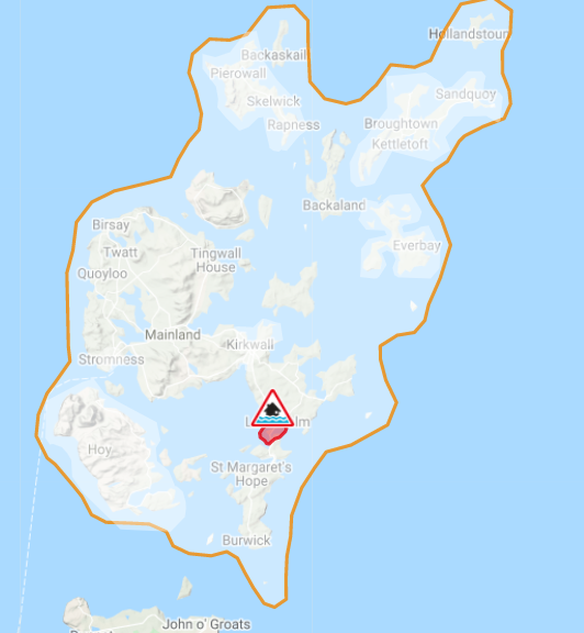
Flood Warning Issued By SEPA
A FLOOD WARNING update has been issued for Churchill Barriers.
A combination of high winds and strong westerly winds means that there is a high risk of wave overtopping and hazardous conditions at the Churchill Barriers during the next 12 hours. Road closures are likely around the time of high tide this evening, Thursday, between 6pm and 8pm.
Remain vigilant and remember, it is your responsibility to take actions which help protect yourself and your property. Advice and information is available through Floodline on 0345 9881188. This FLOOD WARNING UPDATE is now in force until further notice. If you haven’t already signed up to receive free flood messages, please call Floodline or register online at sepa.org.uk/floodingsignup.
Your Floodline quick dial number for this area is 22513


Leave a Reply