
The medieval trading centre of Rungholt drowned in a storm surge in 1362. Mystery and myth grew up around the legend of the lost city. But today combining the forces and research of methods across many disciplines, the hidden history of the town of Rungholt, North Frisia (located today in Germany) is being revealed.
The lost city is located in the UNESCO Wadden Sea World Heritage Site.
Using a combination of geoscientific and archaeological methods, researchers from Kiel University (CAU), Johannes Gutenberg University Mainz (JGU), the Center for Baltic and Scandinavian Archaeology (ZBSA), and the State Archaeology Department Schleswig-Holstein (ALSH), both in Schleswig, have now succeeded in locating the site of the Rungholt church.
Dr. Dennis Wilken, geophysicist at Kiel University explained:
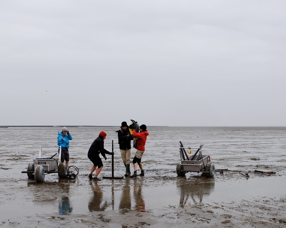
“Settlement remains hidden under the mudflats are first localized and mapped over a wide area using various geophysical methods such as magnetic gradiometry, electromagnetic induction, and seismics.”

Archaeological investigations at selected sites provide unique insights into the life of the North Frisian settlers and bring to light significant new finds from the tidal flats.
In May 2023, a previously unknown two kilometre long chain of medieval terps, ( artificial settlement mounds), was recorded by geophysical prospection near Hallig Südfall. One of these terps shows structures that can undoubtedly be interpreted as the foundations of a church 40 meters to 15 meters in size. First corings and excavations have provided initial insights into the structure and foundations of the sacred building.
Dr Ruth Blankenfeldt, archaeologist at ZBSA, said:
“The special feature of the find lies in the significance of the church as the centre of a settlement structure, which in its size must be interpreted as a parish with superordinate function.”
So far, the finds in the area investigated, which covers more than ten square kilometres, include 54 terps, systematic drainage systems, a sea dyke with a tidal gate harbour as well as two sites of smaller churches – and now also a large main church. The settlement area found must therefore be regarded as one of the historically reported main sites of the medieval administrative district of Edomsharde.
Dr. Hanna Hadler from the Institute of Geography at Mainz University said:
“Around Hallig Südfall and in other mudflats, the medieval settlement remains are already heavily eroded and often only detectable as negative imprints. This is also very evident around the church’s location, so we urgently need to intensify research here”


Leave a Reply