

By Rev James Ritchie from Orcadian Papers (pub 1905)
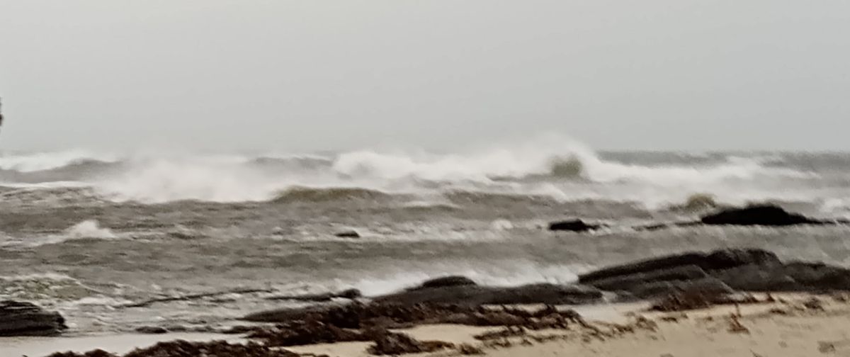
The principal Trap Dyke in this locality is that which goes by the name of the Stacks of Netherton. It crops up first on the seashore a hundred yards or thereby west of the Rocket House, and runs out seaward through the centre of Hoy Mouth, in a west by south-west direction, or thereby, as if pointing to Cape Wrath. Looking landward, it runs in the direction of the farmhouse of Citadale.
At very low tides it can be traced outwards for about a hundred yards continuously; but it looks more picturesque at about half tide, when the tops of merely of the higher parts of it appear above the water in a slightly irregular line, like so many huge stepping stones planted in the sea.
It varies in height and thickness, but near the shore end it must be six feet at least above the ordinary rocks, and four or five feet in thickness. It is extremely hard, and this circumstance, with the fact that it stands end on to the heaviest seas, will account for its remaining erect when the more fragile strata around it have been swept away.
When broken, it exhibits a very dark grey colour, and a cindery structure characteristic of all rocks of volcanic origin. Along each side of the dyke there is commonly a band of a reddish yellow colour in the ordinary flagstone, which has been altered in structure and in colour by the intense heat of the molten trap when it was thrust up from beneath.
Again, anyone walking along the shore of Cairston from the building yard eastward, will cross a trap dyke a little less than a quarter of a mile from the building yard. This dyke is in some places three feet thick, in others rather less. It rises only slightly above the other rocks, and in several places it is on the same level with them.
At the shore end it runs up into the face of the steep rocky bank, standing there some nine feet in height, and as all the ordinary rock on its seaward side has been removed, that side of the dyke is exposed to view for six or seven yards. Raised thus above the sea and long exposed to the weather, especially to the action of the rain water, it has become altered in character, has assumed a rusty red colour and become porous and brittle in substance. The rest of the dyke is of the ordinary type, and at the other end it disappears under the sand of the bay.
It occurred to me to mark particularly the direction in which this dyke ran from the Cairston shore, when I was greatly interested to find that, like the Netherton dyke, it pointed to the farm house of Citadale. The question at once arose, can this second dyke be merely an easterly extension of the first one? It showed the same colour, the same hardness, the same band of red on each side, and it ran in the same direction.
I inferred that if it were the same dyke it would be found crossing the Inner Holm, which lies in its path. Going round to the east side of the Holm, I found it readily, rising out of the sand and running into the Holm at the cave in which, in olden times, smuggled goods, I have been told, were often hidden away until they could be conveniently disposed of. This cave no longer exists. The roof of it has been removed, and a few steps built into the bank now land you on the top of the ancient trap on the shore. The cave, doubtless, owed its origin to the trap.

More nex Sunday on ‘The Trap Dykes of Stromness’


Leave a Reply