
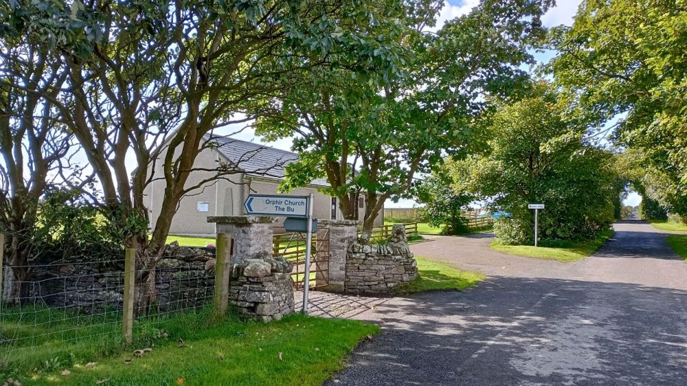
A single track road in Orphir leads to one of the least understood historic sites in Orkney but one which features in the OrkneyInga Saga and was the base for powerful Norse Earls.

Very little remains to be seen of The Earl’s Bu and Round Church but an excellent visitor centre run by the Community Council provides additional information to help visitors wishing to explore this intriguing site.
The visible evidence of occupation includes what is referred to as a Norse drinking Hall and a Round Church. The Round Church, surrounded now by gravestones from a later era, was built in the 12th century and is the only surviving example of its kind in Scotland. Built by Earl Haakon after his pilgrimage to the Holy Land, it is possibly inspired by the Church of the Holy Sepulchre in Jerusalem. Earl Haakon dedicated his church to St Nicholas, a saint associated with high born and royalty, thus identifying himself with the the Norse elite.

Today, only the semi-circular barrel vaulted apse and part of the nave survive. The round church, with its 1.2 metre thick walls, was still complete when referred to in an account of the site by Torfeaus in 1697. Thormodus Torfæus (1636—1719) was an Icelandic historian who published a history of Orkney in 1697 entitled Orcades Seu Rerum Orcadensium Historiae. This was first translated into English in 1866 by the Reverend Alexander Pope of Caithness. Pope supplemented the original text with notes of his own, adding details and observations to update Torfæus’ original text. In 1705 a Church was constructed for the parish to the south of the Round Church and this was when much of the stone was removed from it. Finally when the parish church was demolished to be re- sited in the 1950s, extensive damage was done leaving the very little remaining that we have today.
The Round Church has never been fully excavated. In 1900 stone was cleared out on the floor and several artefacts were found including a fine antler bone case, a runic stone, and two human burials.
Earl Haakon did not build his fine round church on its own but it was located within a complex of other buildings. This was an important estate for Orkney’s Earls with an excellent location on the Northern shore of Orphir Bay, overlooking Scapa Flow. Nearby by was an anchorage, Knarston.


This was an extremely active estate with a mill, fertile farmland, and nearby metalworking. The remains of the horizontal mill shows evidence of under water management. It is likely that the mill and surrounding area was a successful Pictish estate subsequently taken over by the Norse when they settled in greater numbers. A Pictish stone was discovered on the site in 1939. The stone was found to be carved with a crescent and V-rod motif, with a small split rectangle.There is evidence however, of much early occupation with burnt mounds in the surrounding landscape.

The excavation of the mill site in 1939 revealed a stone lined 11th century horizontal mill, the earliest recorded example of its type outside of Ireland and Scandinavia. Finds from the excavation include inscribed runic bones. Working flint materials and saddle querns were also found.
The re-aligned water course to the mill has a stone lined chute to the west, leading from a small pond. The pond is fed by a more substantial water source flowing to the north. The chute led to an underhouse above which were the grinding stones. Surplus water went into the tail race. Lintel stones formed the length of the tail race and the water would flow on to rejoin the main water course. When excavated this whole area was filled with debris from the later Norse complex of the 12th century.


The estate also had a metalworking area, Lavacroon. This was used for the making of silver bullion and small scale working of gold. Silver items, the proceeds of successful raids south and of trade, were melted down to produce transferable wealth in the form of silver ingots.
What is referred to as the Norse Drinking Hall was excavated in the 19th century by George Petrie and in 1939 by Walter Grant and Storer Clouston. Local workmen experienced in archaeological digs were employed to excavate the site. One of those workmen, James Yorston, kept notebooks of the excavation and these are a valuable record. William Grant had acquired the land from the local landowner Henry Sutherland in 1939. Grant then offered the site to the Ministry of Works in 1946/47.
The excavations which took place are incomplete and the site not fully understood. Orphir had become an important estate in the 12th century where the Earls Haakon, Paul and Rognvald, had direct access to the Pentland Firth and Caithness through the shelter of Scapa Flow. This provided an excellent view of shipping sailing into the Flow from the south and west. The estate was also in easy reach of Kirkwall, which by the 12th century was an important ecclesiastical centre with the building of the great cathedral dedicated to Orkney’s saint, Magnus, the murdered cousin of Earl Haakon.

The Orphir Estate was smaller than the great estate at Birsay, 18 pennylands, compared to Brisay’s 135 pennylands, but as the centre of power shifted over the time of the Norse Earls, Orphir, located in the lands of the Paul line of Earls, was extremely important. Its appearance several times in the OrkneyInga Saga is evidence of this.
It is at the Orphir estate where Earl Harald is killed with the poisoned shirt sewn by his mother Helga and her sister Frakokk, during Christmas festivities. It is also where Earl Paul held a great Christmas feast after his defeat of Earl Rognvald. A great number of important guests were invited to celebrate his victory among them Svein Asleifarsson. It is at this feast that Svein kills Svein Breastrope in a drunken brawl and is forced to flee to find safety with Bishop William the Old.
The OrkneyInga Saga gives us a detailed description of the estate.
“The farmstead was a large one, standing on a hillside sloping down behind the farm buildings.” It goes on to described a ‘great drinking hall’, and ‘in front of the hall, just a few paces down from it, stood a fine church.”

The Earl’s Bu was first scheduled in 1938 and taken into state guardianship in 1947. The Round Church, the only example of its kind in Scotland, was scheduled in 1929 and taken into state guardianship in 1952. Today they are cared for by Historic Environment Scotland. The visitor and information centre is run by the Orphir Community Council. The site is also part of the pilgrimage route The St Magnus Way. Never fully excavated and once the home of Orkney Earls this fabulous place leaves many unanswered questions for any visitor to ponder on.

Fiona Grahame


Leave a Reply