
NASA’s Artemis1 is to carry an Arizona State University (ASU) CubeSat into space.
The launching of Artemis 1 which was to take place yesterday, 29th of August has been delayed. NASA confirmed that: “The Space Launch System rocket and Orion spacecraft remain in a safe and stable configuration. Launch controllers were continuing to evaluate why a bleed test to get the RS-25 engines on the bottom of the core stage to the proper temperature range for liftoff was not successful, and ran out of time in the two-hour launch window. Engineers are continuing to gather additional data.”
The Artemis missions are to take human exploration back to the moon for further future travel to Mars.
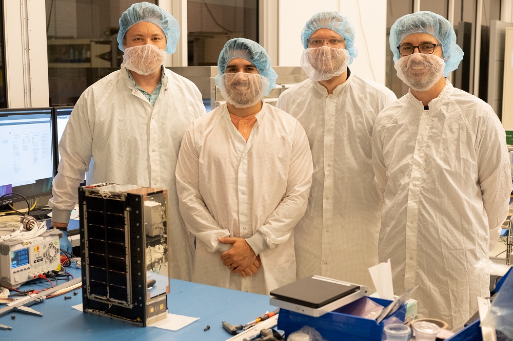
The LunaH-Map is designed to find and map water ice at the Moon’s South Pole. It is one of the tiniest NASA planetary science missions but has big science goals. Previous missions and studies have identified the presence of water-ice at the Moon’s poles. However, there are still unanswered questions about how much water-ice is contained within permanently shadowed regions.

It is also unknown how much water-ice might be retained at depth throughout illuminated regions of the lunar South Pole. LunaH-Map will answer those questions by entering orbit around the Moon and producing a neutron map that will reveal where and how much water-ice is hidden across the lunar South Pole.
LunaH-Map will help us understand the origins of water on the Moon and how it has been redistributed since the Moon’s formation. The maps will also be used to plan future missions and landing sites for robotic and human water-ice prospecting.


Leave a Reply